The Tourist's Guide to Avoiding Fort Myers Traffic Hotspots
Fort Myers ranks as the 23rd most dangerous city for pedestrians among 100 U.S. cities, making traffic Fort Myers navigation crucial for your safety and convenience. While over 450,000 new residents flock to Florida annually, millions of tourists additionally crowd the roads, creating significant congestion challenges.
In fact, popular destinations like Margaritaville and ongoing construction projects, including a $13 million improvement initiative, have intensified traffic concerns on Fort Myers Beach. Your unfamiliarity with local roads, combined with GPS dependence, can make navigation even more challenging. This guide will help you understand peak traffic times, identify congestion hotspots, and discover smart routes to popular destinations, ensuring your Fort Myers visit stays stress-free.
Peak Traffic Times in Fort Myers
Driving patterns in Fort Myers follow distinct rhythms throughout the day and year. Morning commutes see speeds dropping to 26 mph in the city center, with gridlock particularly intense between 7:00 AM and 9:00 AM as workers and students head to their destinations.
Morning rush hour hotspots
Your morning drive through Fort Myers requires careful timing. The average one-way commute stretches to 31 minutes - five minutes longer than the national average. Daniels Parkway experiences significant slowdowns, where a 14-mile journey can take up to an hour during peak times. The most challenging period occurs between 6:00-8:00 AM when traffic crawls at an average speed of 27 mph.
Beach traffic peaks
The January through April tourist season brings extraordinary pressure on local roads. Beach access becomes particularly challenging between 9:00 AM and noon when vehicles stream across the Matanzas Pass Bridge. For smooth beach access, cross the bridge before 9:00 AM to avoid miles-long backups.
Event days and congestion
Evening rush hour presents another significant challenge. Traffic flow slows considerably between 4:00-6:00 PM, with average speeds decreasing to 23.3 mph. Furthermore, specific patterns emerge during weekends:
- Friday afternoons and evenings see heavy traffic as weekend travelers begin their trips
- Sunday afternoons experience significant congestion as visitors return home
- March emerges as the most challenging month, with over 1 million travelers passing through the area
The Fort Myers-Cape Coral area ranks 13th nationwide for congestion, with drivers spending 48 extra hours annually in rush-hour traffic. During peak season, several factors intensify these challenges:
- Post-hurricane recovery efforts bring additional contractor vehicles
- Popular destinations like Margaritaville impact traffic flow patterns
- Tourist activities concentrate during specific timeframes
To minimize delays, consider carpooling or using public transit, especially when heading to island destinations. The traditional evening rush extends from 4:00 PM to 7:00 PM, though traffic typically eases by 7:30 PM, particularly around bridge access points. Understanding these patterns helps you plan your routes more effectively and avoid the worst congestion periods.
Most Congested Areas to Avoid
Traffic data reveals specific trouble zones across Fort Myers that require strategic navigation. The Fort Myers-Cape Coral area stands among the nation's most congested regions, surpassing major cities like Washington D.C. and Houston in traffic density.
Fort Myers Beach bottlenecks
Fort Myers Beach presents significant challenges, as vehicles often stretch for miles down Estero Boulevard. A critical bottleneck forms at Fifth Avenue and Crescent Street, causing extensive delays. The situation intensifies near the Matanzas Pass Bridge base, where illegal U-turns frequently disrupt traffic flow.
To address these issues, traffic officers now monitor two key intersections:
- Old San Carlos Boulevard at Times Square
- Estero Boulevard at Crescent Street
I-75 trouble spots
Interstate 75 experiences over 1,200 crashes annually, resulting in more than 50 fatalities. Major construction projects affect several I-75 sections:
- The SR 951 interchange undergoes significant reconstruction
- Pine Ridge Road interchange converts to a Diverging Diamond design
- Daniels Parkway expansion connects to a planned diverging diamond I-75 interchange
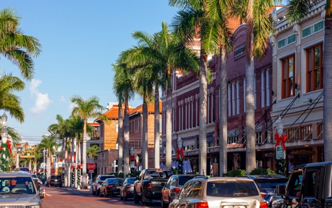
Downtown Fort Myers congestion
Downtown Fort Myers faces mounting traffic pressures, alongside Colonial Boulevard which sees regular congestion throughout business hours. The intersection of Six Mile Cypress and Gladiolus emerges as notably problematic, with local residents describing it as both unpleasant and potentially hazardous.
Several factors compound these congestion points:
- Post-hurricane recovery efforts bringing additional contractor vehicles
- Ongoing $13 million San Carlos Boulevard improvement project
- Limited lighting on bridges and major thoroughfares
Alternative routes exist through Livingston Road, Imperial Parkway, and Three Oaks, offering ways to bypass I-75 and U.S. 41 during peak congestion periods. For beach access specifically, consider walking or biking as optimal alternatives since these methods often prove faster than driving through bottleneck areas.
Smart Routes for Popular Destinations
Knowing the right routes saves precious vacation time in Fort Myers. The LeeTran bus system offers an economical alternative to driving, charging just $1 per ride to Times Square on Fort Myers Beach.
Getting to Fort Myers Beach
Reaching Fort Myers Beach requires strategic planning based on your arrival direction. From I-75, take the Ben Hill Griffin Parkway south to Corkscrew Road, then follow it to US-41 South for a smoother journey. For Miami travelers, exit 116 at Bonita Beach Road provides direct access to the beach.
Consider these time-saving alternatives:
- Use the south entrance via Bonita Beach Road to bypass north-end congestion
- Take Connecticut Street to Shell Mound Boulevard, reconnecting with Estero via Donora Road to save 20 minutes during peak times
Downtown shortcuts
Crystal Drive connects to Metro Parkway, leading to Hanson Street and Evans Avenue, offering relief from main road congestion. For downtown access from Fort Myers Beach:
- Cross Matanzas Pass Bridge northbound
- Follow San Carlos Boulevard until it curves right
- Continue on McGregor Boulevard straight into downtown
Alternatively, take Summerlin Road after crossing to the mainland, which intersects with Cleveland Avenue for downtown access. Both routes typically require 26-45 minutes during rush hour.
The 75-cent trolley service runs the entire 7-mile length of Estero Island, from Bowditch Point Park to Lovers Key State Park. This proves particularly valuable considering ongoing construction projects, such as the $13 million San Carlos Boulevard improvement initiative.
For optimal beach visits, arrive before 9 AM to secure parking and avoid bridge delays. If morning arrival isn't possible, plan to stay until after 7:30 PM when traffic typically subsides. Remember that walking and biking often prove faster than driving through congested areas, particularly around mid-island bottlenecks.
Using Traffic Apps and Cameras
Modern technology offers powerful tools to navigate Fort Myers traffic efficiently. The Lee County Traffic Operations Center monitors road conditions through an extensive network of cameras and sensors, adjusting signal timing to minimize delays.
Best apps for real-time updates
Several navigation apps provide real-time traffic updates tailored to Fort Myers conditions. The Florida Department of Transportation's FL511 app stands out as the state's official source for traffic information, offering:
- Live traffic conditions with voice interaction
- Customizable alerts for your routes
- Access to traffic cameras and message signs
Google Maps remains a popular choice among local drivers, excelling at lane guidance and clean interface design. Moreover, Waze connects you with fellow drivers who share live updates about road hazards, police presence, and bridge backups.
Traffic camera locations
The county maintains strategically placed cameras across major routes:
- I-75 corridor - 36 cameras monitoring key intersections
- Matlacha corridor - Live feeds showing Pine Island Road conditions
- Cleveland Avenue - New pedestrian hybrid beacons at critical crossings
The Lee County Traffic Operations Center uses these cameras alongside microwave vehicle detection sensors at 28 locations to measure speed and traffic volume. This data enables traffic engineers to adjust signal timing promptly, helping reduce congestion at problematic intersections.
The Intelligent Transportation System (ITS) project enhances traffic management at 61 intersections throughout Lee County. This system broadcasts updates through:
- Dynamic message signs displaying real-time conditions
- Highway advisory radio on 1640 AM
- Electronic trailblazer signs directing to alternate routes
For privacy protection, none of these cameras store or record footage. The system primarily serves to help traffic operators identify incidents quickly and coordinate with emergency services. Uninterruptible power supplies at critical intersections ensure continuous monitoring even during power outages.
Conclusion
Navigating Fort Myers traffic requires careful planning and awareness of local patterns. Armed with knowledge about peak times, congestion hotspots, and smart route alternatives, you can save hours of frustration during your visit. Traffic apps and camera systems serve as valuable allies, helping you make informed decisions about travel times and routes.
Safety remains paramount while dealing with Fort Myers traffic challenges.
Remember these key strategies for stress-free travel: arrive at beaches before 9 AM, use alternative routes during peak hours, and consider public transportation options like the LeeTran system. Though Fort Myers faces significant traffic challenges, especially during tourist season, smart planning helps you avoid major delays and enjoy your time in this beautiful Florida destination.
FAQs
Q1. What are the peak traffic times in Fort Myers? The morning rush hour is typically between 7:00 AM and 9:00 AM, while the evening rush hour occurs from 4:00 PM to 6:00 PM. Beach traffic peaks between 9:00 AM and noon, especially during the tourist season from January through April.
Q2. How can I avoid traffic congestion when visiting Fort Myers Beach? To avoid congestion, arrive at the beach before 9:00 AM or after 7:30 PM. Consider using alternative routes like the south entrance via Bonita Beach Road or taking Connecticut Street to Shell Mound Boulevard. Using public transportation, such as the LeeTran bus system or the beach trolley, can also help bypass traffic.
Q3. What are the most congested areas in Fort Myers? The most congested areas include Fort Myers Beach, particularly near the Matanzas Pass Bridge and along Estero Boulevard. Interstate 75 experiences frequent traffic issues, especially around interchanges. Downtown Fort Myers and Colonial Boulevard also face significant congestion during business hours.
Q4. Are there any useful traffic apps for navigating Fort Myers? Yes, the Florida Department of Transportation's FL511 app provides real-time traffic updates specific to Fort Myers. Google Maps and Waze are also popular choices among local drivers, offering live traffic conditions and user-reported hazards.
Q5. Is Fort Myers safe for visitors? While Fort Myers faces some traffic challenges, especially during tourist season, it remains a popular destination. Cape Coral, a nearby city, has been voted one of the safest cities in Florida. By following traffic guidelines and using smart planning strategies, visitors can have a safe and enjoyable experience in the Fort Myers area.
The information on this website is for general information purposes only. Nothing on this site should be taken as legal advice for any individual case or situation. This information is not intended to create, and receipt or viewing does not constitute an attorney-client relationship.